As part of NOAA’s Coastal Storm Awareness Program, ten social science research and related technology transfer projects were funded to improve public response to coastal storm hazard information. In one of these studies, Marlon et al. (2015) found that the majority of coastal Connecticut residents (70%) are either unsure or unaware if their home is in an evacuation zone as determined by flood maps developed by the U.S. Army Corps of Engineers, and 74% of coastal Connecticut residents have never seen an evacuation map for their local community.
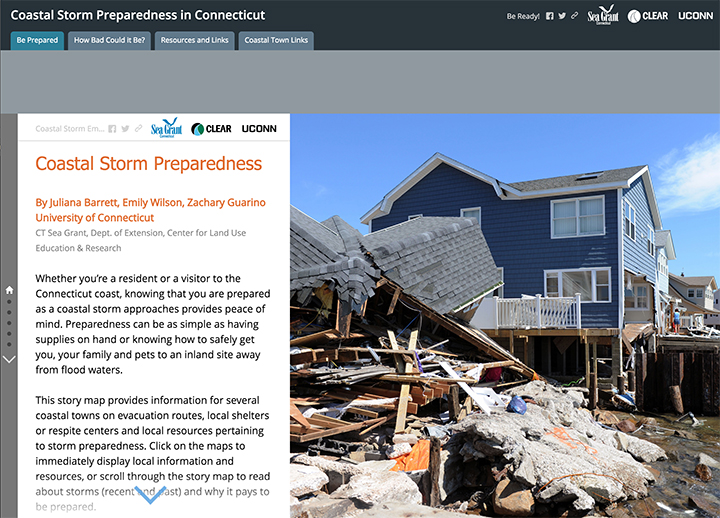
In order to provide information on evacuation zones, local evacuation routes and customized municipal preparedness, Connecticut Sea Grant and UConn CLEAR developed a Coastal Storm Story Map. A story map is a tool developed by the software company, Esri, that allows one to combine interactive online maps with text, images and videos to tell a story. This story map provides information on evacuation zones and local evacuation routes, as well as links to sign up for town emergency alerts. Piloted with four coastal towns, our goal is to have information for all coastal and riverine communities throughout the state. If any town is interested in providing evacuation route and shelter information for the story map, please contact Juliana Barrett at juliana.barrett@uconn.edu.
As a reminder that major hurricanes can hit the Connecticut coast, the story map includes historic aerial photographs and stories from the Hurricane of 1938 which caused massive devastation throughout much of Long Island, NY and New England. This information provides graphic illustration of the powerful flooding and destruction that can accompany such a storm. Also provided are numerous links and resources for storm preparedness from household paperwork to pet safety.