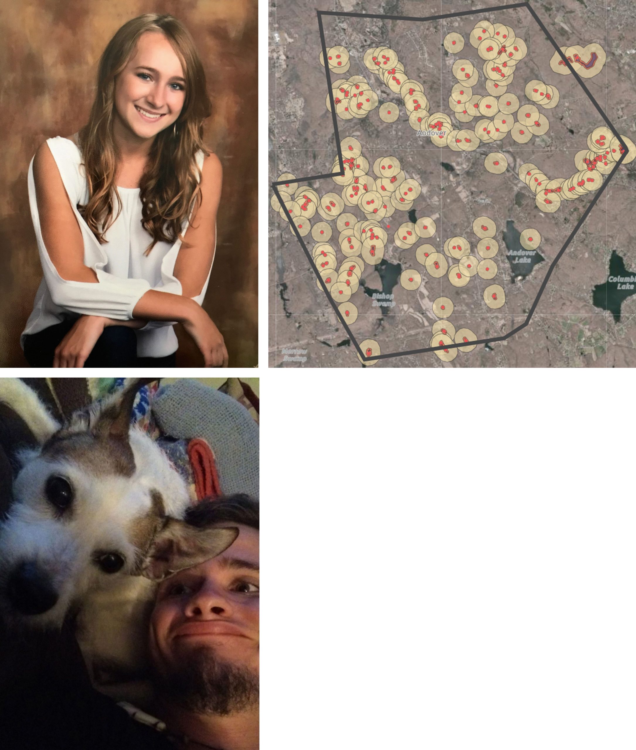
Mapping Vernal Pools in Andover
The Climate Corps worked with the town of Andover, CT’s Conservation Commission to identify potential vernal pool depressions and map them using ArcGIS online to create an interactive map and database for future updates. Through buffer analysis, spatial calculations, and overlays with land cover data, this map also provides critical conservation zones and serves as a crucial first step in the conservation of critical wetland habitat in Andover that will be used and built upon in all later steps of the process.
For Citation Purposes: Connecticut Sea Grant & University of Connecticut’s Center for Land Use Education and Research. (June 7, 2018). Town of Andover. https://climate.uconn.edu/climate-corps/projects/town-projects/andover